
Row G, Mothball Fleet, Suisin Bay, CA
Peer Assessment - Lesson 5: This study is intended to underscore the dynamic nature of map features. Long-term moored vessels such as mothball fleets are notable examples of elements that will highlight differences in the satellite images used to develop maps. There are several maps embedded on this site. First is a standard Google Maps small map to show the general location. The next is an ESRI/ArcGIS rendition with map annotations based on current imagery which is at least 2-3 years old (I marked ships that have been moved in the past few years with a Black Anchor) click on an anchor for more detail. The same imagery is apparent in Bing Maps rendition following. The third overview is from Wikimapia that uses Google Maps and it reflects a much more current view. The bottom example is an embedded ESRI map showing where the missing vessels went, click on the icons to get additional details.
One of the three National Defense Reserve Fleets in the United States, NDRF Suisun Bay began operations in 1946 as a storage point for the large number of vessels built during World War Two that were no longer needed in service for the peacetime US Navy and US Government.
Continuing this role to this day, the Reserve Fleet at Suisun Bay works in tandem with its counterparts at Fort Eustis, Virginia and Beaumont, Texas to provide vessels with military utility or logistic value dehumidification of the internal spaces, cathodic protection and general maintenance designed to keep them in the same condition as when they enter the fleet. As a general rule, external painting and other cosmetic-appearance work is deferred since it is not detrimental to the ability to activate and operate the vessel, resulting in most of the vessels appearing to be in far worse shape than they actually are. Ships maintained in the Reserve Fleet are usually held until they are needed for reactivation, are eclipsed in their logistical or military capabilities and scrapped or sold to foreign navies.
|
Data, Image and Information Sources Used for this site include: Wikipedia, WikiMapia, Google Maps, ESRI/ArcGIS, Pacific Battleship Museum, BING Maps, Bing Images, Google Images.
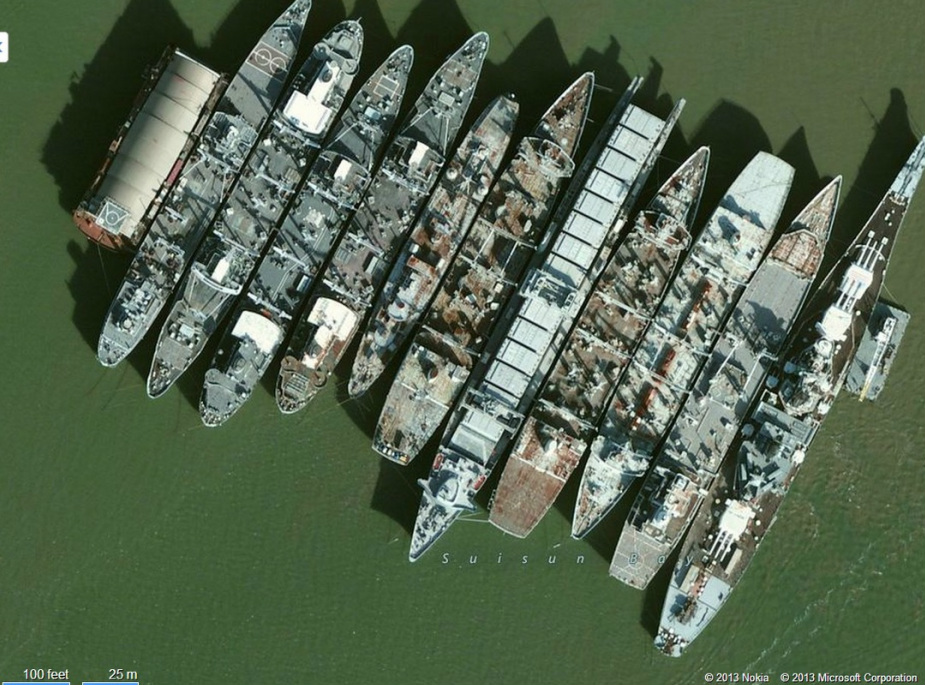
ESRI/ArcGIS source - 3 years out of date (Active embedded Map)
|
Bing Maps image snapshot. Showing the same historical state of the fleet - identical shadows so pretty sure it is the same shot as ESRI.
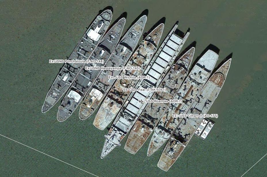
More recent Wikimapia/Google Image snapshot: Row G 2013 - missing ships are: Mispillion (T-AO 105), Kawishiwi (T-AO 146), Nereus (AS 17). Iowa (BB 61)
So where did the missing ships go? (Active embedded Map). Zoom in on Brownsville texas to identify two ships scrapped there.

Thanks to our Instructor's encouragement in the forums to submit more than just a map for the assessment : https://class.coursera.org/maps-001/forum/thread?thread_id=9708
